2030 Dodge Center tornado
| Meteorological history | |
|---|---|
| Formed | March 4, 2030, 12:27 a.m. CST (UTC-6:00) |
| Dissipated | March 4, 2030, 1:41 a.m. CST (UTC-6:00) |
| Duration | 1 hour, 14 minutes |
| EF6 tornado | |
| on the Enhanced Fujita scale | |
| Max width | 2,640 yards (1.5 mi; 2.41 km) |
| Path length | 73.7 miles (118.6 km) |
| Highest winds | 270 mph (430 km/h) |
| Satellite tornadoes | |
| Tornadoes | 1 |
| Maximum rating | EF1 tornado |
| Overall effects | |
| Fatalities | 253 (+4 indirect) (Deadliest tornado on record for Minnesota) |
| Injuries | ≥1,525 |
| Damage | $1.1 billion (2030 USD) (Costliest tornado on record for Minnesota) |
| Areas affected | Freeborn, Steele, Dodge, and Olmsted Counties in Minnesota (mainly the city of Dodge Center) |
|
| |
| Part of the Tornado outbreak of March 3–4, 2030 and Tornadoes of 2030 | |
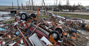
The 2030 Dodge Center tornado was a catastrophic, long-track EF6 tornado that devastated southeastern Minnesota during the early morning hours of March 4, 2030. With peak winds estimated at 270 mph (435 km/h), the tornado carved a 73.7-mile path through multiple communities, including Freeborn, Ellendale, Bixby, Dodge Center, Mantorville, Genoa, Oronoco, and South Troy. It resulted in 253 fatalities and over 1,525 injuries, making it the deadliest tornado in Minnesota history and one of the most violent tornadoes ever surveyed in the United States.
The tornado was part of a widespread and deadly outbreak that began on March 3, 2030. The first tornadic activity occurred in Mississippi, where an EF5 tornado struck Starkville during the afternoon hours. Later that evening, storms initiated across Iowa between 9 and 10 p.m. CST, evolving into a powerful nocturnal supercell complex that progressed into southern Minnesota. At 12:27 a.m. CST on March 4, the Dodge Center tornado touched down, rapidly intensifying and remaining on the ground for over an hour.
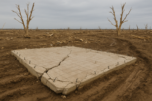
Despite existing warnings, siren failures in Dodge Center, Mantorville, and Oronoco contributed to the high casualty count. The tornado reached EF6 intensity in Dodge Center, where entire neighborhoods were obliterated, foundations were dislodged, and underground infrastructure was granulated. Damage indicators of 260–270 mph were recorded, marking the first official EF6 rating since the Enhanced Fujita scale was updated in late 2029.
Meteorological synopsis
The 2030 Dodge Center tornado was part of a historic and deadly tornado outbreak that unfolded across the central United States on March 3–4, 2030. The Storm Prediction Center (SPC) issued a rare double High Risk outlook for tornadoes—one centered over central Mississippi and another over southern Minnesota and northern Iowa. This marked the first time since 2023 that two separate High Risk zones were issued simultaneously, both driven by tornadic potential rather than hail or wind.
The southern High Risk zone targeted Mississippi, where an EF5 tornado devastated Starkville earlier in the day. Meanwhile, the northern High Risk zone encompassed southern Minnesota, where conditions rapidly deteriorated after sunset. A Marginal Risk area extended across parts of the Great Plains, primarily for damaging winds associated with a fast-moving squall line.
Storm initiation began in Iowa between 9:00 and 10:00 p.m. CST as a potent upper-level trough overspread a highly unstable and sheared environment. Surface dewpoints surged into the upper 60s°F, with temperatures in the low 70s°F across southern Minnesota—exceptionally rare for early March. A strong low-level jet intensified to 70–80 knots, enhancing helicity values to over 600 m²/s² in the warm sector. Mixed-layer CAPE values ranged from 3,500 to 4,200 J/kg, supporting robust updrafts capable of sustaining long-lived supercells.
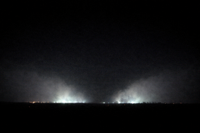
At 12:27 a.m. CST on March 4, the Dodge Center tornado touched down in Freeborn County. It quickly intensified, aided by a deeply curved hodograph and strong directional shear in the lowest 3 km. The tornado remained on the ground for 1 hour and 14 minutes, tracking nearly 74 miles through southeastern Minnesota. Radar imagery showed a persistent and intense debris ball, with dual-polarization signatures indicating lofted debris exceeding 80,000 feet.
The synoptic setup featured:
• 500 mb jet streak: 110–120 knots
• Surface low pressure: ~987 mb centered over eastern Nebraska
• Effective SRH: 550–650 m²/s²
• 0–1 km shear: 40–50 knots
• EHI values: 6.5–8.0 across the High Risk corridor
• STP (Significant Tornado Parameter): locally exceeding 10 in southern Minnesota
These values, combined with nocturnal instability and minimal CINH, created an environment highly conducive to violent, long-track tornadoes. The Dodge Center tornado became the most intense of the outbreak and the first tornado ever rated EF6 following the Enhanced Fujita scale update in late 2029.
Development and track

Impact

Aftermath


