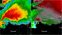
2011 Tuscaloosa–Birmingham tornado (Reanalysis)
Appearance
| Meteorological history | |
|---|---|
| Formed | April 27, 2011, 4:43 p.m. CDT (UTC−05:00) |
| Dissipated | April 27, 2011, 6:14 p.m. CDT (UTC–05:00) |
| Duration | 1 hour, 31 minutes |
| EF4 tornado | |
| on the Enhanced Fujita scale | |
| Path length | 80.68 miles (129.84 km) |
| Highest winds | 190 mph (310 km/h) |
| Overall effects | |
| Fatalities | 64 (+8 indirect) |
| Injuries | 1,500+ |
| Damage | $2.4 billion (2011 USD) |
| Areas affected | Tuscaloosa to Birmingham, Alabama, United States |
|
| |
| Part of the 2011 Super Outbreak and the Tornadoes of 2011 | |


