List of Category 5 arrocanes

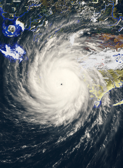
A Category 5 arrocane is the highest classification on the Ardonia Arrocane Wind Scale (AAWS), reserved for tropical cyclones with sustained 1-minute winds of at least 160 mph (260 km/h). These storms represent the most extreme and destructive systems to occur in the Ardonia basin. Due to their rarity and potential for catastrophic impact, Category 5 arrocanes are closely tracked and studied by the National Arrocane Center (NAC) and the Ardonia Meteorological Organization (AMO).
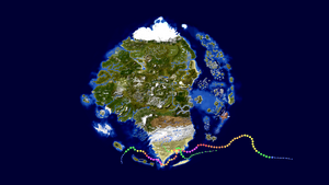
Since reliable records began in 1865, only four storms have reached Category 5 intensity in the basin: Arrocane Nine (1865), Arrocane Arlene (2019), Arrocane Katrina (2019), and Arrocane Milton (2019). Every storm is among the most intense ever recorded, with Arlene setting multiple modern-era records for intensity, rainfall, and impact, and Milton shattering records that even Arlene broke!
Background

Within the Ardonia basin, tropical cyclones are monitored by the National Arrocane Center (NAC), headquartered in Ataraxia, with regional input from multiple National Weather Service offices spread across major kingdoms. The classification of a Category 5 arrocane is based on the Ardonia Arrocane Wind Scale (AAWS), which defines such systems as having 1-minute sustained winds of at least 160 mph (260 km/h). These storms represent the highest level of intensity observed in Ardonian waters and are extremely rare.
Arrocane classification has been part of standardized forecasting since the mid-19th century, when meteorological recordkeeping began during the aftermath of the Great War. However, it is widely believed that several undocumented storms prior to this era may have exceeded Category 5 intensity, particularly over remote oceanic regions or uninhabited coastlines. While instrument-based wind tracking did not exist before 1865, anecdotal reports and ancient weather scrolls compiled by the early kingdoms suggest the presence of "sky-breaker" tempests with similar behavior.
To be officially classified as Category 5 on the AAWS, a storm must exhibit not only extreme wind speeds but also an exceptionally low central pressure and tightly organized structure, typically marked by a small, stable eye and symmetric convection. Category 5 systems often undergo rapid intensification in areas like the Gulf of Ardonia or the warm waters surrounding the Trinity Islands, especially during peak season from July through September.
Advancements in long-range observation, weather balloons, and arcane-pressure telemetry systems have allowed the NAC and the Ardonia Meteorological Organization (AMO) to detect, verify, and archive Category 5 systems with increasing accuracy. As of 2019, only four storms have reached this threshold: Arrocane Nine in 1865, the record-shattering Arrocane Arlene, Arrocane Katrina, and Arrocane Milton in 2019. All storms set historical benchmarks in their respective eras, with Arlene surpassing every known meteorological record on file, later having some of these records broken by Milton.
Due to the overwhelming power and destruction associated with Category 5 arrocanes, the AMO continues to refine criteria, warning systems, and public readiness protocols specific to these rare events. As forecasting improves and climate cycles evolve, future Category 5 systems remain a focal point for both research and regional preparedness.
Systems
| Name | Season | Dates as Category 5 | Peak intensity (mph / mbar) |
Areas affected | Damage (AC) |
Deaths |
|---|---|---|---|---|---|---|
| Arrocane Nine | 1865 | August 26–27 | 165 mph / 911 mbar | Cydonia | $10.2 billion | 138 |
| Arrocane Arlene | 2019 | May 21–22 | 180 mph / 899 mbar | Cydonia, K'arthen, Blade Island | $158 billion | 1,379 |
| Arrocane Katrina | 2019 | July 15-16 | 175 mph / 901 mbar | Felden | $59.0 billion | 207 |
| Arrocane Milton | 2019 | July 14-15 / 15-17 | 200 mph / 865 mbar | Cydonia, Blade Island | $75.0 billion | 437 |
See also
Notes
- Wind speeds are 1-minute sustained.
- Damage estimates are in Ardonian Crowns (AC) and adjusted to 2019 values.
- Only storms that achieved Category 5 on the AAWS are included.
References
- NAC/NWS storm archives
- AMO historical cyclone database
